
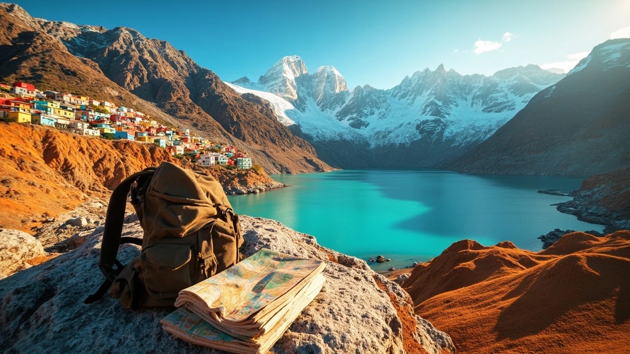
A trip to Chile can feel surprisingly different from one week to the next. In Santiago, travelers walk between glass towers, leafy neighborhoods, and hillside viewpoints. Farther north, the Atacama Desert presents salt flats, high-altitude lagoons, and volcanic scenery. Along the Pacific coast, Valparaíso adds colorful streets and a vivid cultural history. In the far south, glaciers, granite peaks, and turquoise lakes deliver the dramatic landscapes that many visitors first imagine when planning a Chilean journey.
That range creates the main challenge: attractions in chile are spread across a long country with sharply different climates, transport networks, and travel demands. A visitor who treats Chile like a compact city break may underestimate the distances involved. Someone eager for Patagonia, on the other hand, might miss the accessible landmarks around Santiago or the cultural stops along the coast.
The best approach is to choose a small number of priorities, connect them geographically, and leave enough time for weather, roads, reservations, and the simple pace of a place. This guide covers the major attractions in chile and explains which ones suit different kinds of travelers.
Attractions in Chile: where to start your route
Chile stretches more than 4,300 miles from north to south, but most first-time visitors focus on a corridor that runs from the Atacama Desert in the north to Patagonia in the south. The capital, Santiago, provides the easiest starting point for an international arrival. From there, the major travel regions divide into five broad choices:
- City and culture: Santiago, Valparaíso, Viña del Mar, and nearby heritage districts.
- Desert and high-altitude nature: San Pedro de Atacama and the surrounding Atacama landscape.
- Southern scenery and wildlife: Torres del Paine, Puerto Natales, and the wider Última Esperanza area.
- Remote road journey: The Carretera Austral through Chilean Patagonia.
- Coastal culture and island life: Chiloé, the Chilean Lake District, and selected Pacific ports.
These regions work very differently. Santiago can be explored with public transportation and short day trips. The Atacama requires acclimatization to elevation and careful planning around desert conditions. Patagonia demands more time, stronger weather awareness, and a flexible attitude toward transportation. Chiloé rewards travelers who enjoy ferry journeys, coastal scenery, local food, and places where tourism remains connected to everyday community life.
| Region | Best for | Main attractions | Planning reality |
|---|---|---|---|
| Santiago and central Chile | First-time visitors, food, history, easy city access | Historic center, Cerro San Cristóbal, modern city districts | Wide range of lodging and generally straightforward urban transport |
| Atacama Desert | National parks, geology, photography, stargazing | Valle de la Luna, high-altitude lagoons, salt flats, geysers | Plan for altitude, strong sun, and long distances between stops |
| Valparaíso and the coast | Architecture, street art, food, history | Hillside neighborhoods, ascensors, waterfronts, nearby vineyards | Best explored on foot with a few carefully chosen transport connections |
| Torres del Paine | Hiking, wildlife, dramatic mountain scenery | Granite towers, glaciers, lakes, steppe wildlife | Book transport and park lodging before committing to a tight schedule |
| Carretera Austral | Road trips, solitude, fjords, hot springs | Gravel roads, rivers, forests, marble caves, remote settlements | Allow extra time; weather and road conditions can change plans |
| Chiloé | Coastal scenery, mythology, seafood, island culture | Wooden churches, palafitos, national park, ferry routes | Build schedules around ferry availability and seasonal conditions |
One practical rule is to avoid trying to experience every major region on a short trip. A two-week itinerary can combine Santiago, the Atacama Desert, and part of Patagonia with careful flights. A longer journey can add the Carretera Austral or Chiloé, but only by reducing the pace elsewhere. Geography should determine the route, not a list of unrelated destination names.
Santiago attractions for history, food, and an easy first day
Santiago works well as a first stop because it combines a manageable city center with several worthwhile excursions. The historic core sits around Plaza de Armas, where the city’s central stories unfold through civic buildings, churches, cafés, and pedestrian streets. The neighborhood of Barrio Lastarria is known for colorful façades, independent shops, restaurants, and a strong sense of local street life.
Parque Forestal on Cerro San Cristóbal gives visitors a different view of the capital. Paths rise through the park toward mountain scenery and city panoramas, making it a practical place for a half-day outing rather than a full expedition. The summit area includes religious landmarks and broad city views, though the experience does not require joining a crowded tour.
Food offers another way to understand the capital. Visitors can move between markets, neighborhood bakeries, wine bars, and restaurants centered on Chilean ingredients. Empanadas, pastelitos, completos, seafood, and regional wines are easy to sample, while a dedicated restaurant day can introduce more deliberate dishes. Eating in the districts where a meal is served often adds more context than seeking a single “best” restaurant in the center.
- Walk the historic center: Combine Plaza de Armas with nearby lanes and a coffee stop.
- Visit Cerro San Cristóbal: Allow several hours and use the park’s paths or an official visitor transport option.
- Explore Barrio Lastarria: A good choice for architecture, cafés, shops, and a slower evening.
- Add a wine-country day: TheMaipo Valley and Casablanca region offer a different landscape outside the city.
- Leave one day unscheduled: Markets, long lunches, and neighborhood walks are part of the experience, not gaps to fill.
Santiago also serves as a practical base for side trips. The Casablanca and Maipo wine regions are accessible for a day visit, while the coast is a longer outing. For travelers focused on national identity and contemporary city life, two or three days in Santiago provide a strong foundation. Those who want nearby wilderness can use the city as a launch point rather than trying to compress every attraction into one stay.
| Santiago priority | Time to allow | Best fit |
|---|---|---|
| Historic center and nearby landmarks | Half a day to one day | Short stays and travelers interested in urban history |
| Cerro San Cristóbal | Half a day | Families, walkers, and first-time visitors wanting a city overlook |
| Neighborhood food walk | Half a day | Food-focused travelers and those wanting a gentler introduction to the city |
| Casablanca or Maipo Valley | A full day | Visitors who want scenery and wine tasting without a long overseas flight |
Atacama Desert attractions: salt flats, volcanoes, and immense silence
The Atacama Desert in northern Chile is one of the country’s most distinctive regions. Its appeal lies in the clarity of the air, the exposed geology, and the sharp contrast between dry plains, ochre hills, salt-covered basins, and distant volcanoes. San Pedro de Atacama is the usual base for visitors, but the most memorable experiences often occur outside the town.
Valle de la Luna is an accessible introduction to the desert’s sculptural terrain. Visitors walk among ridges and unusual rock formations at the edge of the Salar de Atacama. The experience works well for travelers who have limited time, though it does not represent the full region. The salt flat itself, nearby geysers, high-elevation lagoons, and remote volcanoes require additional driving.
Birdwatching is another major reason to visit the Atacama. Flamingos, geese, and other birds gather around lagoons in the Salar de Atacama and at higher-altitude sites in the Altiplano. Guides who know the local sites can help explain seasonal movement and improve the odds of finding wildlife without creating pressure around sensitive nesting areas.
- Choose a clear-sky night: Light pollution is low in many areas, creating excellent conditions for observing stars.
- Watch elevation: High-altitude lagoons and passes can cause headaches or nausea, especially for visitors arriving directly from sea level.
- Protect cameras and skin: Strong sun and fine dust require sunglasses, sun protection, and a protective camera bag.
- Ask about access rules: Protected areas can have designated routes, restricted zones, and requirements that visitors must follow.
- Leave the salt crust undisturbed: The flat’s fragile surface can show vehicle tracks for years.
Rain is uncommon, but flash floods can occur when storms pass through the high Andes. Travel companies may adjust routes after heavy precipitation, and visitors should not treat an itinerary sheet as a guarantee. Roads can feel simple on a map yet become slow because of altitude, long transfers, or unpaved sections.
| Atacama experience | Landscape | Traveler appeal | Main consideration |
|---|---|---|---|
| Valle de la Luna | Sandstone-like ridges and salt flat | Photography and a short introduction to the desert | Still requires sun protection and an early or late start |
| Salt flat lagoons | White salt, blue-green water, flamingos | Wildlife and wide open scenery | Careful driving around the edge of the salt |
| High-altitude geysers | Desert basins, steam, mineral ground | Geology and geothermal activity | Altitude and variable access |
| Stargazing | Dark desert sky | Astronomy and quiet nights | Choose operators with clear weather policies and suitable equipment |
Most visitors need at least three full days to appreciate the Atacama without treating every day as a transfer. A longer stay allows the region to breathe: one day can be devoted to the salt flat and lagoons, another to geysers and the high plateau, and a third to slower village visits or a rest after long drives. The distance between major stops makes careful coordination more important than adding every point of interest to a list.
Valparaíso attractions: steep streets, harbor views, and Chilean color
Valparaíso has a visual identity unlike Chile’s capital. Its hills rise sharply from the Pacific, with narrow stairways, painted houses, street art, old funiculars, and small passages opening toward the water. The city is best understood on foot, although the vertical geography means that even a short route can involve a significant climb.
The historic center around Plaza Sotomayor is a logical starting point. From there, travelers can explore the painted hillsides, visit the ascensor passages, and look over the port. Cerro Alegre and Cerro Concepción offer the most concentrated streetscape, while Cerro Santa Lucía connects the historic center to a hillside park. These areas reward wandering rather than a strict checklist.
The port and waterfront also tell the city’s story as a former trading center and point of arrival. Nearby Viña del Mar has a different atmosphere, with a long beach promenade, gardens, and a more conventional resort layout. Combining the two cities works well for a longer coastal stay, but a day trip can feel rushed if the main goal is to understand Valparaíso’s steep residential neighborhoods.
- Start early: The city is quieter before tour groups and the day’s heat build.
- Wear supportive shoes: Cobbles, stairs, and steep inclines are more demanding than the short distance on a map suggests.
- Carry water: Water, shade, and rest stops are not equally distributed across the hills.
- Use ascensors thoughtfully: They are part of the heritage experience, but queues can form during busy periods.
- Explore beyond the headline murals: Residential lanes, workshops, and ordinary street life reveal more than the best-known photo spots.
Food is another attraction, particularly in neighborhoods that developed around port labor and maritime commerce. Seafood, fish, empanadas, and complete meals are easy to find, while small bars and bakeries provide a more intimate way to sample the city. Visitors who want to learn about Chilean culinary history should allow time for a meal rather than treating it as a brief stop between landmarks.
For a broader comparison of landmark-focused itineraries, Ecuador famous landmarks: 10 spots worth the trip offers another perspective on how natural scenery and cultural sites can be combined in a South American itinerary. The Chilean capital provides a useful counterpoint to the port city: Santiago is centered on modern metropolitan life, while Valparaíso is defined by its port, hills, and historic relationship with the sea.
Torres del Paine attractions: mountains, lakes, and wildlife at close range
Torres del Paine is often the centerpiece of a Chile itinerary because the landscape combines granite towers, glaciers, turquoise lakes, open steppe, and forests in a relatively compact park. The famous towers are only one part of the experience. Visitors also encounter wind-shaped trees, rivers, ice fields, and animals adapted to the severe Patagonian environment.
The park supports different styles of visit. A day trip can reveal the major viewpoints and is useful for travelers with limited time in Puerto Natales. A longer stay allows visitors to follow multi-day trails, take wildlife-focused boat excursions, explore quieter valleys, or simply wait for changing weather to reveal different views. The scale of the park can make short visits feel busy and long visits feel spacious.
Guadalupe Lake is one of the best-known starting points for scenery, while routes toward French Valley offer views of glaciers, hanging ice, and mountain walls. The base of the towers involves a demanding climb, so visitors should judge the trail by their own fitness and experience rather than treating it as a casual photo stop. Weather can turn a simple walk into a cold, windy hike even when conditions elsewhere in the park are mild.
- Match the route to your fitness: A full hiking itinerary and a lodge-based visit are not interchangeable.
- Prepare for variable weather: Wind and rain can arrive quickly even during warmer months.
- Protect wildlife: Keep a respectful distance from guanacos and other animals, and never approach feeding stations.
- Carry reusable water containers: Refill points and planning reduce unnecessary plastic waste.
- Do not overpack the day: Long transfers, trail delays, and weather pauses can turn an ambitious itinerary into a rushed one.
| Way to visit Torres del Paine | Ideal for | Main advantage | Tradeoff |
|---|---|---|---|
| Day visit from Puerto Natales | Short itineraries and first-time visitors | See major viewpoints from a manageable base | Limited time in the park and more time in transit |
| Park lodge stay | Travelers wanting scenery without daily hiking | Comfortable access to trails and lookout points | Availability and advance booking matter |
| Multi-day trek | Active hikers seeking deeper access | More varied landscapes and a stronger sense of distance | Fitness, weather, and booking demands are higher |
| Wildlife-focused visit | Birders and visitors interested in ecosystems | Expert interpretation and access to appropriate habitats | Wildlife remains wild and sightings are never guaranteed |
Most travelers need three days in the park to feel a sense of space. Two can work for an active itinerary, while one is better treated as an introduction. Accommodations inside and around the park have limited inventory, so it is sensible to coordinate flights, buses, and lodging before purchasing inflexible plans. A buffer day in Puerto Natales can protect the main experience if transportation runs late.
Carretera Austral attractions: the journey becomes the destination
The Carretera Austral is not simply a road between two cities. It is a remote Patagonian route where distance, weather, and limited services shape every decision. The route extends roughly 1,240 kilometers from Puerto Montt to Villa O’Higgins, with paved sections, gravel roads, ferry crossings, and settlements that provide basic supplies rather than large-scale tourism.
This route suits travelers who want to slow down. Forest, rivers, fjords, glaciers, and snow-covered peaks appear along the way, but reaching a viewpoint can require a slow climb over loose gravel. The scenery is not compressed into a few roadside stops. It accumulates through long stretches of travel.
A detailed account of driving the Carretera Austral describes the road’s remoteness, the usefulness of a four-wheel-drive vehicle, and the importance of allowing time for weather, mechanical issues, and delayed ferries. It also highlights detours near Marble Caves, Queulat National Park, and the hot springs at Puyuhuapi. Those stops belong to a journey measured in days rather than a quick scenic loop.
- Plan for services: Fuel, food, lodging, and communications become less frequent toward the south.
- Drive slowly: Loose surfaces, steep passes, single-lane sections, and sharp changes in weather demand concentration.
- Carry offline information: Download maps and keep copies of reservations and emergency details.
- Keep a flexible buffer: A landslide, storm, ferry delay, or vehicle problem can consume a planned day.
- Protect the remote environment: Pack out waste and avoid driving where vehicles are not permitted.
Food and social contact can be as memorable as the landscape. Roadside cafés and small settlements offer a sense of Patagonia’s working communities, although services can be simple and hours may reflect local needs rather than tourist schedules. Visitors should not rely on a restaurant being open at the moment they arrive.
| Route consideration | Why it matters | Practical response |
|---|---|---|
| Unpaved sections | Passenger cars may manage many stretches, but loose gravel and steep grades can be demanding. | Choose a vehicle suited to the road and drive at a conservative speed |
| Long gaps between services | Fuel and supplies may not be available where travelers expect them. | Refuel conservatively and carry an emergency food supply |
| Ferries and weather | A crossing may not operate when roads on either side are clear. | Keep the itinerary flexible and confirm the current travel method |
| Remote settlements | Basic services may be limited, and visitor infrastructure is modest. | Set realistic expectations and respect community space |
| Limited communication coverage | Mobile service can be inconsistent. | Travel with offline maps, emergency contacts, and a satellite communication option where appropriate |
The BBC source recommends allowing roughly seven to ten days for the complete route, with additional margin for disruptions. It also identifies December through March as the better weather period while noting that summer storms can still occur. For most travelers, completing the full Carretera Austral is less important than selecting a coherent section. The northern section near Chaitén and Puyuhuapi is accessible to more varied itineraries; the road farther south calls for stronger logistics and a slower mindset.
Chiloé attractions: wooden churches, coastal myths, and island roads
Chiloé has a distinctive culture shaped by its island location, maritime history, and blended Indigenous and European influences. It is often associated with colorful palafitos, elaborate wooden churches, seafood, and stories of the Caleuche, a legendary underwater people said to appear in coastal fog. Its attractions feel different from the monumental landmarks of Santiago or the mountain scenery of Patagonia.
The island’s churches are major cultural landmarks and form part of a UNESCO World Heritage grouping. Their carved interiors, painted details, and wooden construction reward a closer look rather than a quick exterior photo. Castro is the best-known town for its stilt houses, while coastal roads reveal rocky coves, beaches, lighthouses, and working harbors.
Chiloé National Park provides a different side of the island, with temperate rainforest, tidal channels, coastal cliffs, and views toward the mainland. Access is divided among several sections, so travelers should choose the part that fits their interests rather than assuming the park is a single circular route. Kayaking and boating can reveal landscapes that are less visible from the road.
- Visit a church beyond Castro: Smaller communities often have distinctive interiors and a more intimate atmosphere.
- Look beyond the palafitos: Working waterfronts and residential lanes reveal everyday island life.
- Ask locally about seafood: Availability changes with weather and fishing conditions.
- Allow for ferries: Public and private services operate on schedules that should guide the itinerary.
- Watch the tides: Coastal walks and boat trips depend on water and weather conditions.
| Chiloé experience | Main appeal | Best time investment | Main constraint |
|---|---|---|---|
| Church and heritage route | Wooden architecture and local craftsmanship | Two to three days | Transport between communities takes time |
| National park visit | Rainforest, coast, and marine scenery | One to two active days | Weather and access conditions vary |
| Kayaking or boating | Islands, channels, and wildlife | Half day to full day | Weather cancellations are possible |
| Island road trip | Harbors, coastal scenery, and village life | Three or more days | Ferry connections and distance shape the route |
Chiloé works well for visitors who want to linger. It also pairs naturally with the wider Chilean Lake District, where boat routes, mountain scenery, and towns around lakes broaden the journey. The combination is best for travelers who value local texture over a tightly packed checklist.
How to combine attractions in Chile without rushing the trip
The most effective Chilean itineraries connect places that make geographical sense. Combining Santiago and the Atacama is straightforward because flights move between the capital and northern Chile. Adding the coast creates another logical step, but only if the traveler wants urban streets as well as open desert and mountain scenery. Patagonia should be treated as a separate commitment rather than a quick addition to a northern route.
For a first trip, a practical sequence is Santiago, the Atacama Desert, and Torres del Paine. Santiago provides an accessible introduction, the Atacama delivers desert scenery and wildlife, and Torres del Paine offers a concentrated Patagonian experience. Fly rather than attempting to cover the entire country by road. This approach minimizes backtracking and leaves more energy for the final and most weather-sensitive destination.
Travelers who prefer road journeys can spend several days on the Carretera Austral instead of fitting Torres del Paine, Puerto Natales, and Chiloé into the same schedule. Those places may appear close on a regional map, but roads, ferries, and remoteness make them distinct travel chapters.
- First-time visitor, about two weeks: Santiago, the Atacama Desert, and Torres del Paine, connected by flights.
- Nature-focused visitor, about two weeks: Santiago, the Lake District or Chiloé, and one focused Patagonian route.
- Road-trip traveler, three weeks or more: A dedicated section of the Carretera Austral with limited transfers.
- Culture and food traveler: Santiago, Valparaíso, and additional time in coastal towns, with fewer distant wilderness stops.
- Hiking-focused visitor: Torres del Paine plus a clearly selected trekking route, supported by extra recovery time.
| Trip style | Best regions | Number of travel days | Planning priority |
|---|---|---|---|
| Classic first trip | Atacama, Santiago, Torres del Paine | About 12–16 days | Flights, park lodging, and a Patagonia weather buffer |
| Scenic road trip | Carretera Austral | About 10–14 days | Vehicle suitability, fuel, and flexible reservations |
| Culture and cities | Santiago, Valparaíso, Viña del Mar | About 6–9 days | Neighborhood time and local food reservations |
| Islands and lake country | Chiloé and selected Lake District routes | About 8–12 days | Ferry schedules and weather alternatives |
No single route is best for everyone. A first-time visitor may gain more from Santiago and the Atacama than from adding a distant drive. An experienced traveler may prefer to spend fewer days in major cities and reserve time for Patagonia. The key is to distinguish experiences that are genuinely incompatible from attractions that can coexist naturally.
When comparing a northern South American itinerary with other landmark routes, Sao Paulo Brazil: a straight-talk guide for first timers offers a useful reminder that distance, neighborhood character, and practical transit planning matter just as much as the headline attractions. The same principle applies in Chile: build around the time and energy available rather than copying a destination checklist.
Planning checklist for a smooth Chile itinerary
Good planning reduces the number of days lost to avoidable mistakes. Start with regional travel, because domestic flights and long bus routes determine how much time remains for sightseeing. Then reserve the activities that have limited capacity, such as accommodation near Torres del Paine, selected Atacama excursions, or Carretera Austral stays. Flexible tickets are especially valuable when weather may disrupt outdoor plans.
Seasonality varies dramatically across the country. The north is dry and can be intensely sunny at high elevation, while Patagonia can experience rapid weather changes. The central part of Chile includes both Mediterranean conditions in many areas and wetter winters in selected locations. Rather than relying on one national forecast, check the conditions for the exact regions and elevations on the route.
Passport, entry, and health requirements can change, so travelers should confirm them through official channels before departure. The same applies to park rules, transport bookings, and the operating status of excursions. A guide, hotel, or transport operator can provide useful local context, but official information should remain the basis for current requirements.
- Passport and documents: Confirm validity, entry rules, and any requirements for children or transit countries.
- Internal transport: Book the connection that creates the least risk, not merely the cheapest one.
- Accommodation: Confirm the location, transfer method, and check-in time for remote stays.
- Weather layers: Pack for sun, wind, rain, and large daily temperature changes in Patagonia.
- Altitude preparation: Discuss medical considerations with a qualified clinician when traveling to high elevations.
- Cash and connectivity: Carry backup payment methods and offline maps for places with unreliable service.
- Documents offline: Save hotel details, ferry tickets, emergency contacts, and reservations on a phone and in a paper backup.
- Travel insurance: Check coverage for weather disruption, medical evacuation, rental vehicles, and the specific activities planned.
Packaging should reflect activities rather than a generic checklist. Desert visitors need sun protection and refillable water containers. Hikers need weather layers, reliable footwear, and a daypack sized for their route. Coastal travelers benefit from wind-resistant clothing and comfortable walking shoes. Drivers on the Carretera Austral should keep emergency supplies accessible without treating an emergency kit as a substitute for suitable equipment and cautious driving.
Finally, leave room in the itinerary. Chile’s distances are meaningful, and a schedule with no margin makes one delayed flight or ferry affect everything after it. A final practical step is to decide which two or three experiences matter most. Protect those in the schedule first, then arrange everything else around them rather than forcing every attraction into the trip.
Frequently asked questions
What are the best attractions in Chile for a first visit?
For a first visit, Santiago, the Atacama Desert, and Torres del Paine offer a strong mix of city culture, desert scenery, wildlife, and mountain landscapes. Travelers with less time may choose Santiago and the Atacama, while those focused on hiking can devote most of their stay to Torres del Paine. Flights are generally the most efficient way to connect these distant regions.
How many days are needed to visit Chile?
A meaningful trip usually needs at least two weeks. One week works for Santiago, Valparaíso, and selected nearby destinations, or for a tightly planned Patagonian visit. Two weeks allow travelers to combine the Atacama with Patagonia, while three weeks or more make the Carretera Austral, Chiloé, or a slower multi-region itinerary more practical.
Is Patagonia or the Atacama Desert better for a nature-focused trip?
Patagonia is the stronger choice for mountains, glaciers, forests, fjords, and hiking. The Atacama is better for desert geology, salt flats, high-altitude lagoons, flamingos, and stargazing. Both are dramatic, but they demand different preparation. Patagonia requires attention to wind, weather, and trail conditions; the Atacama requires more attention to elevation, sun, and long desert transfers.
Do you need a rental car to see the attractions in Chile?
No. Santiago and Valparaíso can be explored using urban transport, walking, and organized day trips. The Atacama is often visited with guided excursions, and Torres del Paine is commonly reached by bus, flight, or arranged transfer. A rental car becomes more useful for independent road travel, particularly on the Carretera Austral, where the chosen vehicle must suit unpaved and steep sections.
Is the Carretera Austral difficult to drive?
Yes, it requires preparation and patience. The route includes paved and unpaved sections, loose gravel, steep passes, limited services, ferry crossings, and weather disruption. A four-wheel-drive vehicle is generally the safer choice for the complete journey, although careful drivers may manage many sections in ordinary vehicles. Travelers should allow extra days and avoid turning a remote road into a tightly timed race.
Can travelers visit Torres del Paine as a day trip?
Yes, a day trip can cover the park’s main viewpoints and is common for travelers based in Puerto Natales. The experience is more compressed than a longer stay because driving and waiting consume much of the day. Active visitors may prefer two or more days to reach trails, watch changing weather, and visit less crowded parts of the landscape.
What is the best time to visit the Atacama Desert?
There is no single correct month, because the region’s climate and altitude affect what visitors can do. Winter can offer cool desert temperatures and excellent stargazing, while warmer periods bring stronger sun and busy travel periods. High-altitude sites can remain cold even when nearby towns feel warm. Travelers should consider elevation, recent weather, and the activities on their itinerary rather than choosing solely by air temperature.
Is Chiloé worth adding to a Chile itinerary?
Chiloé is worth adding for travelers interested in maritime culture, wooden churches, coastal scenery, local food, and a slower pace. It is less suitable for someone who wants only major cities, large museums, and rapid transfers. Ferry schedules and weather should shape the route, and a visit of three or more days allows more than a quick stop between larger destinations.
What should travelers pack for Patagonia?
Pack layers that can handle strong wind, rain, and rapid temperature changes, along with waterproof outerwear, sturdy footwear, and a daypack. Even mild-looking days can become cold on exposed water or mountain trails. Travelers also need sun protection, water, navigation downloads, and enough emergency supplies to remain safe if a drive takes longer than expected.
What is the best way to avoid rushing through Chile?
Choose fewer regions and give each one enough time for its main activities, local neighborhoods, weather, and transfer days. Flights can connect distant highlights without consuming days behind a wheel. Keep at least one flexible day near Patagonia, reserve limited-capacity activities early, and avoid scheduling a long drive immediately before a flight, ferry, or guided excursion that cannot easily absorb a delay.
Leave a Reply