
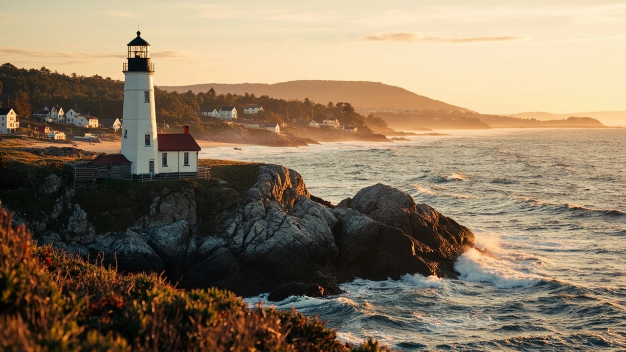
New england facts: six states, one distinct region
New england facts usually come up when travelers want a clear answer to a basic question: what exactly is New England, and why do people treat these six northeastern states as a single destination? The short answer is that New England is a fixed geographic and administrative region comprising Connecticut, Maine, Massachusetts, New Hampshire, Rhode Island, and Vermont. It extends from the Atlantic coast inland toward the Appalachian Mountains and north into Canada. The region has no single government, but it shares a compact geography, a long colonial and Indigenous history, and several traditions that remain visible in its cities, towns, and landscapes.
New England is also not a synonym for Boston. The six states contain ocean beaches, mountain ranges, deep forests, historic ports, university towns, farmland, and small village centers. Boston is the largest city in the region and the capital of Massachusetts, but much of the area’s character comes from places beyond the city. Understanding these new england facts helps travelers choose between a city break, a coastal drive, a mountain trip, or a route that combines several landscapes without assuming everything is within a short walk of Boston.
This guide focuses on the region itself: its boundaries, physical geography, history, government, cultural patterns, seasons, and practical planning considerations. It does not treat the region as a single attraction with one schedule or price. Instead, it offers the background needed to compare destinations intelligently and build a realistic trip.
What states are considered part of New England?
The official answer is six states. There are no territories or additional states included in the regional definition. Each state has its own capital, government, landscape, and travel rhythm, yet the six are commonly grouped because of their shared Atlantic position, colonial history, and physical geography.
| State | Capital | Geographic character | Best way to think about it |
|---|---|---|---|
| Connecticut | Hartford | Coastal cities, the Connecticut River Valley, and inland towns | A convenient mix of cities, shore trips, and small-town New England |
| Maine | Augusta | Atlantic coast, islands, lakes, forests, and northern wilderness | The largest state by area and a strong choice for longer road trips |
| Massachusetts | Boston | Boston, Cape Cod, the Berkshires, and islands | The region’s main urban and cultural center with varied day trips |
| New Hampshire | Concord | Mountains, lakes, seacoast, and the Connecticut River Valley | A compact destination for scenery, outdoor recreation, and small towns |
| Rhode Island | Providence | A small Atlantic state centered on Providence and Narragansett Bay | Compact and easy to combine with nearby Massachusetts and Connecticut |
| Vermont | Montpelier | Green Mountains, rural valleys, farms, and village centers | A rural counterpoint to the region’s dense cities and coast |
The boundaries are more definite than those of many cultural regions. New England lies east of New York, north of Long Island Sound, and south of the Canadian provinces of Quebec and New Brunswick. The Atlantic Ocean and the Gulf of Maine form much of its eastern and southeastern edge.
That compact geography is one of the most useful new england facts for trip planning. A traveler can reach a different environment without crossing the country: coastal Maine and central Massachusetts may look completely different, while the mountains of New Hampshire and Vermont form their own connected landscape. Distances still matter, however. A route that links Boston, rural Maine, and the White Mountains can cover a substantial amount of ground.
Six facts that make the geography easy to understand
- Boston is the largest city. Greater Boston contains more than half of the region’s population, which explains why many travelers use it as a base.
- Worcester is the second-largest city in New England. It is part of the broader Greater Boston metropolitan area rather than a separate central destination.
- Manchester is New Hampshire’s largest city. Providence is both the capital and largest city of Rhode Island.
- Long Island Sound forms part of the southern edge. The coast is more than a single beach destination; it includes harbors, sounds, islands, and working ports.
- The region has named mountains, rivers, and valleys. They are useful reference points even for visitors who do not know the local geography.
- State borders do not follow one landscape rule. Coastal terrain, river corridors, and the foothills all help define the way the region developed.
What is the geography of New England?
New England’s physical landscape changes quickly when viewed from south to north or from the coast inland. Southeastern New England has a narrow coastal plain, while western and northern areas are dominated by rolling hills and the worn-down peaks at the northern end of the Appalachian Mountains. This combination makes the region suitable for both shoreline sightseeing and drives through forested or mountainous terrain.
The Atlantic fall line lies close to the coast. That feature allowed many early settlements and later industrial centers to use rivers for water power. The Connecticut River is especially important because it runs through the region and helped connect inland communities with the coastal trade network. Today, the rivers remain visible in the landscape through towns, bridges, floodplains, recreation areas, and preserved industrial sites.
| Landscape | Where it is most noticeable | Typical travel experience | Planning consideration |
|---|---|---|---|
| Atlantic shoreline | Maine, Massachusetts, Rhode Island, and coastal Connecticut | Harbors, beaches, coastal walks, lighthouses, and changing views of the water | Allow for variable coastal weather and check road conditions during storms |
| Islands | Maine’s coast and waters around Massachusetts | Ferry travel, maritime scenery, seafood stops, and quiet visits | Vehicle space and schedules can be limited, so confirm arrangements before travel |
| River valleys | Connecticut River Valley and smaller inland corridors | Historic towns, farms, river walks, and easier east-west travel | Corridor towns can make a useful stop between larger urban areas |
| Mountains and highlands | New Hampshire, Vermont, western Maine, and Massachusetts | Scenic drives, hiking, overlooks, and foliage seasons | Longer drives and seasonal traffic can make advance planning important |
| Forests | Northern Maine, New Hampshire, Vermont, and inland areas | Woodland roads, lakes, trail access, and remote scenery | Remote travel requires attention to fuel, mobile coverage, and supplies |
The geography also explains the abundance of compact settlements. Many parts of New England contain numerous small municipalities commonly called towns. Their names often include the word “town,” but they can function like cities or villages rather than rural farmsteads. This local government structure is one of the more distinctive new england facts for anyone interested in civic traditions.
How did New England become part of the United States?
Human presence in the region long predates European colonization. Indigenous communities were living in the area at least 10,500 years ago and probably earlier. Before European settlement, agriculture and ceramics had already become part of the regional record. Groups speaking Eastern Algonquian languages included the Abenakis, Mi’kmaq, Penobscot, Pequot, Mohegan, Narragansett, Nipmuc, Pocumtuck, and Wampanoag peoples.
European exploration and trade intensified during the late 16th and early 17th centuries. Traders exchanged metal, glass, and cloth for beaver pelts. The name “New England” was used by English explorer John Smith in 1616 and received official sanction through a royal charter in 1620.
The Pilgrims established Plymouth Colony in 1620 and signed the Mayflower Compact before leaving the ship. Massachusetts Bay Colony followed, with Boston established as its major port in 1630. Settlement, religious conflict, trade, imperial rivalry, and war shaped the colonies for generations. The region also experienced devastating conflicts between settlers and Indigenous communities, including the Pequot War and King Philip’s War. These events cannot be reduced to a simple story of European arrival.
The late 18th century brought conflict with Great Britain over taxation, trade restrictions, and colonial self-government. The Boston Tea Party was one response to British enforcement policies. Britain then imposed punitive measures commonly called the Intolerable Acts, which restricted Massachusetts government. Fighting began in 1775, and British authorities were expelled from the region in 1776.
Later, New England became an important center of abolitionist activity and the first U.S. region transformed on a large scale by the Industrial Revolution. Water power, textile production, manufacturing, ports, and improved transportation helped cities grow while also bringing labor exploitation, crowded housing, pollution, and social conflict.
A historical overview of the region’s geography and development provides useful context for understanding why present-day cities and towns are arranged as they are. History remains especially visible in the region because much of its settlement pattern is relatively old, even when individual buildings are much newer.
Why do so many New England towns use town meetings?
Many municipalities in New England are divided into small towns, and residents often exercise local authority through town meetings rather than through a conventional elected municipal government. The town meeting can place civic decisions directly in front of residents, including discussions about local budgets, public works, schools, zoning, and other community matters.
This system has practical consequences for travelers. In some communities, the annual or special town meeting is part of the local calendar. A visitor who arrives expecting a mayor and council will discover a more direct form of local government. Elsewhere, a municipality may have a select board or town manager while preserving traditions associated with meetings.
Another important fact is that “town” does not always mean “urban.” New England towns can contain villages, residential communities, commercial centers, farmland, forest, and shoreline. Vermont and Connecticut are especially associated with village-style local government, while unincorporated areas remain in portions of Maine, New Hampshire, and Vermont.
- Local government boundaries do not always match the boundaries visitors use for neighborhoods or attractions.
- A village center may sit inside a larger town rather than operate as a separate municipality.
- Town meeting traditions vary by place, so current local procedures should be confirmed before attending or participating.
- State government handles matters such as taxation policy, state roads, public institutions, and statewide regulations.
- National parks, federal land, tribal territories, and private properties follow additional rules within the region.
The prevalence of town meetings is not evidence that every decision is made by a direct public vote. It is better understood as a distinctive local tradition that varies from town to town. That distinction matters for anyone researching civic history or building a trip around community events.
What cultural traditions define New England?
New England has a strong cultural identity, but it is not a single uniform culture. The region is often described through contrasts: Puritan inheritance alongside later liberalism, agriculture alongside industry, isolation alongside immigration, and inherited traditions alongside new forms of cultural expression. Those tensions make the region more varied than its popular image sometimes suggests.
Food is one visible expression. New England is associated with dishes such as clam chowder, baked beans, lobster rolls, crab cakes, and baked fish, but the regional table also reflects the people who have arrived from elsewhere. Boston’s large immigrant communities have made the city a center of Ethiopian, Vietnamese, Chinese, Mexican, Portuguese, Italian, Irish, and other culinary traditions. A visitor seeking only traditional “New England food” may miss much of the region’s present-day food culture.
Architecture also varies by place. Colonial-era meetinghouses, saltbox houses, brick mills, Greek Revival buildings, Victorian houses, coastal cottages, and modern city blocks can sit near one another. Preservation is important, but the region is not a museum held at a single date. Historic structures are often adapted for shops, housing, offices, restaurants, and community organizations.
| Cultural feature | Where it is easiest to encounter | What travelers may notice |
|---|---|---|
| Maritime heritage | Maine coast, Massachusetts harbors, Rhode Island, and coastal Connecticut | Working ports, boatyards, seafood traditions, ferries, and maritime museums |
| Colonial and early American history | Plymouth, Boston, Newport, and older Connecticut towns | Meetinghouses, historic districts, preserved homes, and walking tours |
| Literary and intellectual traditions | Massachusetts, Connecticut, New Hampshire, and Vermont | Writers’ homes, university communities, bookshops, and literary landscapes |
| Indigenous history and contemporary tribal nations | Across the region, including federally recognized tribal communities | Language, food, art, history programs, and place-based traditions |
| Contemporary arts and food | Boston, Providence, Portland, and college towns | Independent music, theater, museums, global cuisine, and new creative districts |
Seasonal traditions also shape visits. Autumn foliage, coastal storms, winter recreation, spring gardens, and summer shore trips create different versions of the region. The best month depends less on a single calendar date than on which landscape and activities a traveler wants to prioritize.
What seasons are best for visiting New England?
There is no single best season for all of New England. Boston and the coastal areas can be visited throughout much of the year, while mountain conditions, foliage timing, and winter access can be more seasonal. Rather than treating spring as automatically ideal or autumn as automatically crowded, match the season to the trip.
| Season | Best suited for | Advantages | Tradeoffs |
|---|---|---|---|
| Spring | Gardens, hiking at lower elevations, quieter city visits, and mild coastal walks | Fresh landscapes and a chance to avoid peak summer demand | Mud on trails, variable temperatures, and some seasonal attractions may not yet be operating |
| Summer | Coastlines, islands, lakes, hiking, and outdoor events | Long daylight and the widest range of warm-weather activities | Higher lodging demand, traffic near popular destinations, and reduced lodging availability |
| Autumn | Foliage drives, scenic villages, short hikes, and photography | Distinctive seasonal color and atmospheric landscapes | Foliage timing varies by elevation and latitude; weekends can be busy |
| Winter | Skiing, snow towns, museums, and quiet city itineraries | Snow-covered scenery and strong winter recreation options | Severe storms, icy travel, limited access to remote roads, and weather-related cancellations |
Autumn foliage does not peak across the region on one date. Northern Maine generally changes earlier than southern coastal areas, while elevation affects timing within individual states. A flexible itinerary is usually more useful than planning around a single Friday. Travelers who cannot adjust their dates can reduce disappointment by treating foliage as a possibility rather than a guaranteed event.
Winter access also varies. Boston, Providence, Hartford, and other urban centers remain useful year-round, but a mountain road, coastal ferry, or remote attraction may operate on a different schedule. Check official park, road, and ferry notices close to travel, especially when storms are forecast.
Spring and early summer can suit travelers who prefer fewer crowds, but waterfalls, trails, and boat services may begin operating later in some locations. Winter can be excellent for museums, restaurants, and urban neighborhoods, where the atmosphere is different from a mountain resort. These distinctions are among the most practical new england facts for choosing a season.
How can a first-time visitor plan a New England road trip?
A useful road trip begins with a geographic priority. Trying to cover all six states in a short vacation can result in long drives and little time in the places that matter most. New England rewards routes based on a theme: coast, history, mountains, food, or an arrival city with nearby day trips.
For a first visit, many travelers use Boston as a base because of its museums, restaurants, public transportation, and concentration of major attractions. A drive to the boroughs and regions of New York can also help travelers understand the broader northeastern landscape. It is a separate destination, but comparing urban New York with compact New England cities is useful for deciding how much metropolitan energy suits your interests.
Three broad trip styles work particularly well:
- City and culture: Spend several days in Boston, then add Providence or another nearby center. Use local transit and short day trips rather than moving hotels every night.
- Coastal route: Focus on the Massachusetts coast, Cape Cod, Newport, Rhode Island, and coastal Connecticut. Build in time for detours because the shoreline rewards slower travel.
- Mountains and inland towns: Combine New Hampshire and Vermont, adding western Massachusetts or Maine when the schedule allows. This route suits scenic drives, hiking, and village stays.
Travelers with more time can create a north-south itinerary linking Boston and coastal Massachusetts with Portsmouth, the Maine coast, and perhaps Acadia National Park. That trip requires more driving, so it works better with a flexible schedule and fewer overnight changes.
For advance planning, use the following checklist:
- Choose two or three landscape priorities before selecting overnight stops.
- Map realistic driving days rather than calculating only total mileage.
- Check whether a ferry, scenic railway, trail, or attraction requires a reservation.
- Keep the first and final days light to reduce disruption from delays.
- Leave room for weather in coastal and mountain areas.
- Confirm seasonal road conditions, park access, and operating schedules close to departure.
- Save offline maps because rural coverage can be inconsistent.
- Pack a light rain layer even when the forecast for the trip start looks clear.
Visitors who prefer landmarks can compare New England’s historic sites with a broader approach to important landmarks worth traveling for. The comparison is less about direct similarity than learning which types of places deserve time, interpretation, and reliable access.
Frequently asked questions
How many states are in New England?
New England contains six states: Connecticut, Maine, Massachusetts, New Hampshire, Rhode Island, and Vermont. Each has its own state government, and Boston is the largest city in the region.
Which New England state should I visit first?
Massachusetts is convenient for a first visit because Boston concentrates major museums, restaurants, universities, and nearby coastal and inland attractions. Maine suits travelers who want longer drives and a stronger emphasis on coast and wilderness. New Hampshire and Vermont are especially practical for mountains, lakes, and small towns, while Rhode Island is compact and easy to combine with Massachusetts or Connecticut.
Is Boston the same thing as New England?
No. Boston is the capital of Massachusetts and the largest city in New England, but the region includes five other states and thousands of smaller municipalities. Greater Boston contains more than half the region’s population, which makes the city disproportionately important to visitors.
What is the best time to see autumn foliage in New England?
Timing varies by latitude, elevation, and local weather, so there is no reliable single date for the entire region. Northern Maine generally changes earlier than southern coastal areas. Travelers with flexible dates have the best chance of finding good color, while those on a fixed schedule should treat peak foliage as a possibility rather than a guarantee.
Does New England have good food?
Yes. The region is known for seafood, chowder, baked beans, and other traditional dishes, but its strongest food culture includes the many communities that shaped Boston, Providence, and other cities. A well-planned visit can include both classic New England cooking and the area’s extensive international restaurant scene.
Are New England’s towns really governed by town meetings?
Many are associated with town meeting traditions, which can give residents a direct role in local government. Procedures differ by municipality, and not every decision is necessarily decided in the same manner. Visitors interested in attending should verify the local schedule and rules in advance.
What is New England’s best-known historical event?
American history contains many significant events connected to the region. The Pilgrims established Plymouth Colony in 1620, colonists challenged British taxation and trade policies in the 1770s, and Boston became a center of abolitionist and industrial history. New England facts usually place these events within the longer story of Indigenous habitation, colonization, and cultural conflict.
Can I visit New England by train?
Rail travel can connect Boston with several nearby cities and is useful for travelers who want to avoid driving. Coverage is not equally convenient for every rural destination, island, or mountain town. Compare the route with the locations you actually want to visit rather than assuming rail access covers the entire region.
Is New England suitable for a family road trip?
It can be. Coastal science centers, museums, aquariums, historic sites, compact towns, and accessible state parks provide varied activities. The best route depends on the ages of the travelers and the length of the trip. Shorter drives between well-chosen bases are usually more comfortable than covering the whole region in a single week.
What are the least crowded New England places to visit?
Timing and route choice matter more than a universally quiet destination. Many visitors focus on Boston, coastal Maine, Newport, and the White Mountains. Rural New Hampshire, inland Vermont, western Massachusetts, and smaller Maine towns can offer a calmer experience, especially outside peak foliage weekends. Check local attraction schedules because quieter places may have reduced operating days outside the main season.
What should I pack for a New England trip?
Pack layers, comfortable walking shoes, and rain protection. Summer visitors may need sun protection and insect repellent for wooded areas, while winter travelers should be prepared for snow, ice, and rapidly changing road conditions. Ferry riders and coastal visitors may find wind and cool temperatures even during warmer months.
Leave a Reply